Business Details
Expert Land Surveying Services in San Clemente, CA
Borchard Surveying & Mapping has established itself as a trusted provider of professional land surveying and mapping services in Orange County and coastal regions. With over 25 years of specialized experience, our team leverages state-of-the-art technologyincluding Total Stations, GPS instrumentation, and Electronic Data Collectorsto deliver precise, legally sound solutions for architects, civil engineers, legal firms, and individual property owners. Our expertise extends beyond technical execution to include deep knowledge of land law, evidenced by our creation of legally binding property descriptions and expert witness testimony in land disputes. We maintain a full-service survey crew capable of handling complex projects ranging from boundary and topographic surveys to ALTA/ACSM standards and floodplain certifications. Our commitment to quality is reflected in long-term partnerships with public works entities and developers, where we provide construction staking, easement mapping, and GPS control networks.Clients benefit from our ability to interface seamlessly with design professionals and field contractors while maintaining rigorous adherence to municipal filing requirements. We prioritize client education, offering guidance on selecting appropriate surveys and navigating permitting processes. Our reputation for responsiveness and technical excellence has been built through decades of delivering accurate, court-defensible documentation. By combining innovative methodologies with traditional surveying principles, we ensure our clients receive actionable data that meets both regulatory and practical needs. This dedication to precision and service quality positions us as leaders in Orange County's land surveying industry.
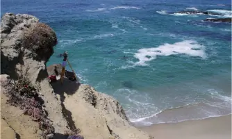
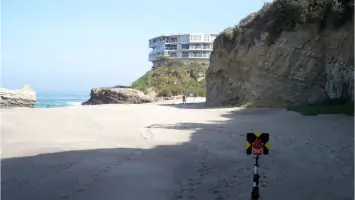
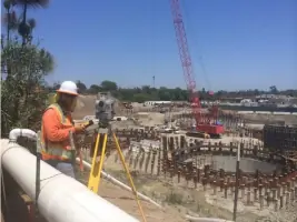
Services
Boundary Surveying
Legal Descriptions
Expert Witness Testimony
Topographic Surveys
ALTA/ACSM Surveys
Construction Staking
GPS Horizontal Control
Floodplain Certifications
Condominium Plans
Highlights and features
- We have over 25 years of experience in land surveying and legal descriptions
- Our team uses state-of-the-art GPS and photogrammetric control equipment
- We provide expert witness testimony in land dispute cases
- Our crew handles complex public works and development projects
- We maintain rigorous standards for legally defensible documentation
Associations and certifications
- Professional Land Surveyor (PLS)
Services
Boundary Surveying
Our boundary surveys establish precise property lines using advanced GPS technology and historical record research. We deliver legally defensible documentation for real estate transactions, development projects, and dispute resolution. Clients receive detailed maps and legal descriptions that meet municipal filing requirements.
Legal Descriptions
We create legally binding property descriptions required for real estate transfers and easement agreements. Our surveyors combine field measurements with title research to ensure accuracy. These documents serve as official records for property boundaries and land use rights.
Construction Staking
Our construction staking services guide infrastructure development with precise field markings. We use GPS control networks to ensure alignment with design plans for roads, buildings, and utilities. This ensures compliance with engineering specifications and regulatory standards.
Topographic Surveys
We produce detailed elevation models and terrain features using photogrammetric control and field measurements. These surveys support site planning, drainage analysis, and environmental assessments. Clients receive digital and printed maps showing natural and man-made features.
ALTA/ACSM Surveys
Our ALTA/ACSM surveys meet national standards for commercial property transactions. We identify boundary lines, easements, and improvements through comprehensive field work and title research. These surveys include detailed maps and legal descriptions for title insurance purposes.
People
Greg Borchard
Professional Land Surveyor
With over 25 years of experience, Greg Borchard specializes in boundary surveys, legal descriptions, and expert testimony. He holds a Professional Land Surveyor license and has worked on complex public works projects across Orange County.
Questions
What services do you offer?
We provide boundary surveys, legal descriptions, construction staking, topographic mapping, ALTA/ACSM surveys, and expert witness testimony for land disputes.
How much does a boundary survey cost?
Costs vary based on property size and complexity. Contact us for a customized quote after reviewing your specific requirements and property characteristics.
Do you work with individual homeowners?
Yes, we assist homeowners with boundary disputes, property additions, and land development projects requiring precise survey documentation and legal descriptions.
Are your surveys legally binding?
Our surveys meet professional standards and include legally defensible documentation when performed by our licensed Professional Land Surveyor.
What areas do you serve?
We primarily serve Orange County and coastal regions including San Clemente, Newport Beach, and Irvine, California.