Business Details
Your Trusted Land Surveying Partner in Temecula
LCF Surveying has been a trusted provider of land surveying, civil engineering, and site development services for over 45 years. Our team, led by Leonard Fowler, a licensed land surveyor with extensive expertise, delivers precise and reliable solutions tailored to residential, commercial, and agricultural projects. We specialize in boundary surveys, topographic mapping, UAV drone technology, and legal document preparation to support property development and dispute resolution. Our commitment to accuracy and client satisfaction ensures that every project meets the highest industry standards. With a focus on innovation and traditional surveying excellence, we serve clients across Temecula, Murrieta, Fallbrook, and surrounding regions.Our services include encroachment exhibits, elevation certificates, parcel and tract maps, and roadway dedications to facilitate compliance with local regulations. By combining advanced technology with decades of hands-on experience, we provide actionable data that empowers informed decision-making. Our clients, including wineries, residential developers, and agricultural enterprises, rely on our expertise to navigate complex land use challenges. We prioritize clear communication and transparency, offering free consultations to align our services with client goals. As a licensed and insured firm, we uphold the integrity and professionalism essential to safeguarding property investments.
Services
Land Surveying
UAV Drone Surveying
Legal Documents
Mapping
Civil Engineering
Site Development
Parcel Maps
Tract Maps
Highlights and features
- We offer 45+ years of specialized expertise in land surveying and civil engineering.
- Our team uses UAV drone technology for high-accuracy mapping and data collection.
- We provide tailored solutions for property line disputes, boundary surveys, and legal compliance.
- Our licensed professionals ensure all projects meet local regulatory standards.
- We serve diverse clients, including wineries, residential developers, and agricultural enterprises.
Services
Land Surveying
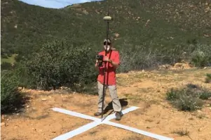
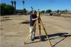
Our land surveying services include boundary determination, property line dispute resolution, and topographic mapping using GPS and conventional methods. We deliver precise data for residential, commercial, and agricultural projects. Our surveys ensure compliance with local regulations and support legal documentation.
UAV Drone Surveying
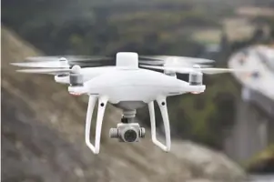
UAV drone surveying captures high-resolution aerial data for topographic maps, site analysis, and construction monitoring. This technology enhances accuracy and efficiency for large-scale projects. Clients receive detailed 3D models and geospatial data to inform planning and development.
Legal Documents
We prepare court-ready legal documents, including encroachment exhibits, elevation certificates, and parcel maps. These documents are essential for property transactions, zoning compliance, and dispute resolution. Our licensed surveyors ensure all filings meet regulatory standards.
Mapping
Mapping services include topographic maps, contour lines, and site improvement diagrams. These maps visualize terrain features, boundaries, and infrastructure for engineering and development projects. We use advanced tools to ensure clarity and precision for client needs.
Civil Engineering
Civil engineering support covers site planning, roadway dedications, and drainage analysis. We collaborate with developers to design functional, code-compliant infrastructure. Our expertise streamlines permitting and ensures projects align with municipal requirements.
People
Leonard Fowler
Principal Surveyor
Leonard Fowler, a licensed land surveyor with 45+ years of experience, specializes in boundary surveys, civil engineering, and construction. He leads LCF Surveying's efforts to deliver accurate, client-focused solutions for complex land use challenges.
Questions
What services does LCF Surveying offer?
We provide land surveying, UAV drone mapping, legal document preparation, and civil engineering services for residential, commercial, and agricultural clients.
How long has LCF Surveying been in business?
Our team has over 45 years of combined experience in land surveying and site development projects.
What areas do you serve?
We serve Temecula, Murrieta, Fallbrook, Menifee, and surrounding regions in California.
Can you handle legal property disputes?
Yes, we conduct boundary surveys and prepare encroachment exhibits to resolve property line disputes.
Do you use drone technology?
Yes, we utilize UAV drones for high-accuracy mapping and site analysis to enhance project efficiency.