Business Details
29 Years
experience
Professional Land Surveying Services in Corona, CA
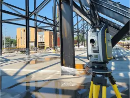
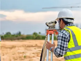
Cornerstone Land Surveying, Inc. is a licensed, insured small business based in Corona, California, dedicated to delivering precise and reliable land surveying solutions. Our team of three licensed surveyors brings over 75 years of combined experience in development and capital improvement projects, utilizing state-of-the-art Trimble Robotic and GPS equipment to ensure efficiency and accuracy. We pride ourselves on exceeding client expectations through innovative methodologies, cost-effective approaches, and a commitment to quality service. With expertise spanning ALTA surveys, boundary determination, construction staking, and subsurface utility scanning, we serve both public and private sectors.Our client-centric philosophy emphasizes transparency, integrity, and personalized support, ensuring seamless project execution. Backed by advanced technology and a proven track record, we provide tailored solutions that meet diverse surveying needs. Our mission is to empower clients with confidence through precise data and exceptional service, while our vision is to lead the industry as a trusted partner in land surveying excellence.

Services
A.L.T.A. Surveys
Boundary Surveys
Construction Staking
GPS Control Surveys
Photogrammetry
Utility Research
Topographic Surveys
Subsurface Utility Scanning
Potholing Services
Details
- Year established: 1997
Highlights and features
- We offer 75+ years of combined experience in land surveying for development and infrastructure projects.
- Our team utilizes state-of-the-art Trimble Robotic and GPS equipment for accurate results.
- We provide client-centric solutions with a focus on transparency and personalized service.
- Our licensed surveyors ensure compliance with industry standards and project specifications.
- We deliver cost-effective, expedient surveying solutions tailored to complex project requirements.
What people say
Exceptional service
Impressed with their accuracy
Cutting-edge technology
Responsive and thorough
Seamless project execution
Services
A.L.T.A. Surveys
ALTA surveys provide standardized boundary determinations for lenders and title companies. Our team ensures compliance with national standards through meticulous deed research and precise field measurements. This service supports property transactions and development projects with legally defensible documentation.
Construction Staking
We deliver precise construction staking for public and private projects using digital plans and GPS technology. Our licensed surveyors ensure accurate placement of utilities and structures, minimizing rework and reducing project costs through expert field verification.
Subsurface Utility Scanning
Advanced ground-penetrating radar and electromagnetic methods identify hidden utilities without excavation. This service prevents infrastructure damage during construction by mapping underground systems when as-built records are unavailable or incomplete.
Photogrammetry
Aerial photography and digital orthophotos create detailed topographic maps for large sites. Our 2-3 week turnaround provides accurate base maps for design professionals, integrating seamlessly with CAD software for efficient project planning.
Potholing Services
Non-destructive vacuum excavation precisely identifies utility locations and materials. Using the Vacmaster 4000, we expose underground lines safely to prevent damage, ensuring worker safety and project compliance with regulatory standards.
People
Stefan C. Lanthier
President
Stefan has led Cornerstone since 1997 with Christian values emphasizing integrity. As a licensed Civil Engineer, Land Surveyor, and Contractor, he ensures technical excellence and client satisfaction across all projects.
Questions
What surveying services does Cornerstone offer?
We provide ALTA surveys, boundary determination, construction staking, photogrammetry, utility research, subsurface scanning, and potholing services for residential, commercial, and public works projects.
How does Cornerstone ensure survey accuracy?
We use Trimble GPS and robotic equipment combined with 75+ years of professional expertise to deliver precise measurements that meet or exceed industry standards.
Do you handle both public and private projects?
Yes, we serve government agencies and private developers with equal expertise in infrastructure and land development surveying requirements.
What technology do you use?
Our tools include Trimble GPS systems, ground-penetrating radar, electromagnetic locators, and digital photogrammetry equipment for comprehensive data collection and analysis.
How quickly can you complete a project?
Aerial mapping projects typically finish in 2-3 weeks. Timelines vary by scope, but our advanced technology ensures efficient delivery without compromising quality.