
Business Details
We are a premier land surveying firm built on a foundation of dedication to accuracy and quality work. Our principal, Randy Mayer, is a licensed Professional Land Surveyor (PLS #7024) with a license active since 1994. He began his distinguished career at Caltrans, gaining invaluable public sector experience before transitioning into private practice. With almost 30 years of professional experience, we possess a depth of knowledge that ensures precision on every project. We subsequently founded this firm to deliver superior surveying solutions directly to our clients. Our expertise spans a wide variety of residential and commercial projects, from small-scale lot adjustments to large-scale construction staking.
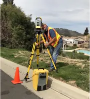
We leverage state-of-the-art technology and equipment to provide the most reliable data possible. Our commitment to solving complex boundary and mapping challenges is unwavering. We prioritize clear communication and professional standards, ensuring that every project receives the meticulous attention it deserves. We take pride in being your friendly neighborhood surveyor, dedicated to serving the Inland Empire with integrity.
We leverage state-of-the-art technology and equipment to provide the most reliable data possible. Our commitment to solving complex boundary and mapping challenges is unwavering. We prioritize clear communication and professional standards, ensuring that every project receives the meticulous attention it deserves. We take pride in being your friendly neighborhood surveyor, dedicated to serving the Inland Empire with integrity.
Highlights and features
- We bring almost 30 years of licensed surveying experience.
- Our founder started his career at Caltrans before entering the private sector.
- We utilize state-of-the-art technology and equipment for precision.
- Our work is built on a foundation of accuracy and quality.
Services
Boundary Survey
We perform boundary surveys to determine precise property boundaries and corners for our clients. This service is essential for anyone needing to identify the exact limits of their land or resolve potential encroachments. Our accurate work provides peace of mind and legal clarity for residential and commercial property owners.
Topographic Survey & Mapping
Our topographic survey and mapping services capture the elevation and features of a land parcel using advanced technology. We serve clients requiring detailed terrain data for design and planning purposes. This information is critical for architects, engineers, and developers working on both small and large-scale projects.
Construction & Project Staking
We provide construction and project staking for small and large-scale residential and commercial clients. Our process ensures that planned improvements are built in the correct location according to the design plans. We help contractors avoid costly errors by providing reliable and precise field layout services.
Title Research
We offer a specialty service that provides clarity on property history and ownership through comprehensive title research. This investigative process is vital for uncovering historical records that may affect current property rights. We assist clients in resolving ownership questions and ensuring a clean chain of title.
FEMA Elevation Certificate
We supply FEMA Elevation Certificates to support property owners with floodplain management and insurance requirements. This service documents the elevation of a building relative to the Base Flood Elevation. We help clients secure accurate documentation that may be necessary for compliance and lowering insurance premiums.