Business Details
Professional Land Surveying Services in Saco, ME
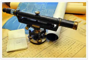
Since 1864, Dow & Coulombe has been a trusted provider of professional land surveying services across Maine. Our legacy began with W.S. Dennetts work on the Saco Rivers industrial infrastructure and coastal subdivisions, evolving through generations of expert surveyors who established standards adopted statewide. With over 150 years of accumulated land records, including the largest privately owned collection in Southern Maine, we deliver unmatched historical context and precision. Our team of three Professional Land Surveyors, boasting 95 years of combined experience, adheres to rigorous state and national standards, ensuring every project meets exacting legal and technical requirements. We specialize in boundary surveys, topographic mapping, ALTA/ACSM land title surveys, and FEMA elevation certifications, serving residential, commercial, and municipal clients.Our work has withstood legal scrutiny for decades, with no surveyed boundary ever proven incorrect in court. As past leaders of the Maine Society of Land Surveyors and contributors to statewide licensure standards, we combine institutional knowledge with modern methodologies. Our staff includes seasoned professionals recognized for expertise in subdivision design, construction layout, and expert witness testimony. We maintain active memberships in the Maine Society of Land Surveyors and the American Congress of Surveying and Mapping, reinforcing our commitment to industry excellence. For every project, we prioritize thoroughness, accuracy, and client-specific solutions, ensuring reliable results for properties of all sizes.
Services
Boundary Surveys
Topographic Surveys
ALTA/ACSM Surveys
FEMA Elevation Certificates
Land Records Research
Expert Witness Testimony
Highlights and features
- We offer 150+ years of continuous land surveying expertise in Maine.
- Our staff includes three licensed surveyors with 95 years of combined experience.
- We maintain the largest privately owned land records collection in Southern Maine.
- No surveyed boundary has ever been proven incorrect in court.
- Our team includes former leaders of Maines professional land surveyor organizations.
What people say
150+ years of expertise
Accurate boundary surveys
Extensive land records
Expert witness credibility
Municipal project experience
Services
Boundary Surveys
We conduct precise boundary surveys to establish or retrace property lines using historical records and modern technology. Our work ensures legal compliance for real estate transactions, development projects, and dispute resolution. With over 150 years of experience, we guarantee accuracy that has never been challenged successfully in court.
Topographic Surveys
Our topographic surveys map natural and man-made features, including elevations, vegetation, and structures. This data supports construction planning, environmental assessments, and land development. We use advanced tools to deliver detailed, actionable site analyses for residential and commercial clients.
ALTA/ACSM Surveys
We perform ALTA/ACSM land title surveys to meet national standards for commercial property transactions. These comprehensive surveys identify easements, encroachments, and legal restrictions, ensuring title insurance requirements are satisfied. Our expertise protects clients investments through meticulous documentation.
FEMA Elevation Certificates
We provide FEMA elevation certificates to determine flood risk and insurance requirements. Our surveys measure building elevations relative to flood zones, supporting accurate floodplain management and compliance with local regulations for coastal and inland properties.
Land Records Research
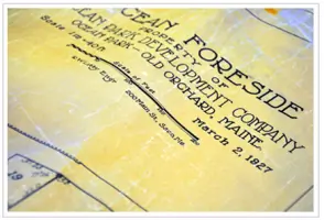
We analyze historical land records, including deeds, maps, and surveys dating to 1864, to resolve boundary disputes and support legal cases. Our proprietary archive contains thousands of documents from predecessor firms, offering unparalleled context for property history investigations.
People
Peter Deletetsky
President
Licensed since 1978, Peter has 40+ years of experience in subdivision layout, boundary retracement, and expert witness testimony. He oversees survey crews and ensures adherence to state and national standards.
Michael Coulombe
Vice President
Licensed since 1986, Mike specializes in boundary law, subdivision design, and GPS applications. He previously taught surveying courses and contributes to professional education initiatives while managing complex field operations.
Questions
What land surveying services do you offer?
We provide boundary surveys, topographic mapping, ALTA/ACSM land title surveys, FEMA elevation certificates, land records research, and expert witness testimony.
How long have you served Maine clients?
Since 1864, making us one of the oldest continuously operating land surveying firms in the region.
Do you have historical land records?
Yes, we maintain the largest privately owned collection of land records in Southern Maine, dating to the 1860s.
Which areas do you serve?
We work throughout Southern and Mid-Maine, including Biddeford, Saco, Kennebunk, and coastal communities.
Are your surveyors licensed professionals?
All survey work is conducted by three licensed Professional Land Surveyors with 95+ years of combined experience.
Can you handle complex legal survey disputes?
Yes, our surveys have never been proven incorrect in court, and our team provides expert witness testimony.