Business Details
Professional Land Surveying Services in Southern Maine
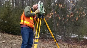
Survey, Inc. is a full-service land surveying company based in Windham, Maine, serving Southern Maine since the 1970s. Our team combines over 120 years of collective experience in land and engineering surveys, utilizing advanced CAD software and GPS technology to deliver precise results. We specialize in boundary surveys, subdivisions, topographic mapping, ALTA/NSPS land title surveys, and FEMA flood certifications, catering to residential homeowners, developers, engineers, and legal professionals.Acquired by current partners in 2015, we maintain a client-focused approach, prioritizing responsiveness and accuracy. Our affiliations with the Maine Society of Land Surveyors and the National Society of Professional Surveyors reflect our commitment to industry standards. We serve both year-round and seasonal residents of the Sebago Lake region, ensuring timely service for projects ranging from single property lines to large-scale commercial developments.
Services
Land Surveys
Boundary Surveys
Subdivisions
Topographic Surveys
FEMA Flood Certificates
ALTA/NSPS Surveys
Engineering Surveys
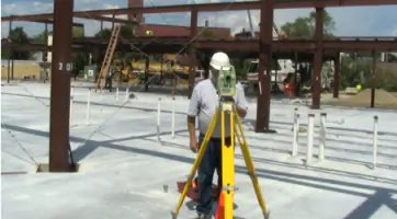
Construction Layout
Route Alignment
Hydrographic Surveys
Highlights and features
- We combine over 120 years of collective experience in land surveying.
- Our team uses advanced CAD software and GPS equipment for precision.
- We serve both residential and commercial clients across Southern Maine.
- Our responsive approach ensures timely completion of projects of all scales.
- Affiliated with the Maine Society of Land Surveyors and National Society of Professional Surveyors.
Services
Land Surveys
Our land surveys provide precise boundary definitions and property data using advanced GPS and conventional equipment. Services include ALTA/NSPS land title surveys and subdivision planning for residential and commercial clients. We ensure compliance with state standards for legal and development purposes.
Boundary Surveys
Boundary surveys establish accurate property lines for lot splits, construction, or dispute resolution. We analyze historical records and use modern technology to deliver legally defensible results, ensuring clarity for property improvements and ownership rights.
Topographic Surveys
Topographic surveys map natural and man-made features, including elevation changes and existing structures. This data supports engineering and construction projects, providing critical insights for site development and infrastructure planning across Southern Maine.
FEMA Flood Certificates
We conduct FEMA flood certifications to determine property flood zones and compliance requirements. Our surveys support flood insurance applications and LOMA requests, helping clients mitigate risks and meet regulatory standards for coastal and inland properties.
Engineering Surveys
Engineering surveys support infrastructure projects with route alignment, construction layout, and utility mapping. We collaborate with engineers and developers to ensure precise data for roadways, utilities, and site development, using GIS and hydrographic tools for accuracy.
People
William C. Shippen
Managing Partner
William C. Shippen leads Survey, Inc. with decades of expertise in land surveying, overseeing operations and client relations. His leadership ensures adherence to industry standards and timely project delivery.
John W. Swan
CFO
John W. Swan manages financial operations at Survey, Inc., combining surveying knowledge with fiscal oversight to support the company's growth and client-focused service model.
Devin J. Pike
Staff Surveyor
Devin J. Pike contributes specialized surveying skills, conducting fieldwork and data analysis to ensure precision in boundary and topographic surveys for residential and commercial clients.
Derick R. Rollins
Party Chief
Derick R. Rollins supervises field operations as Party Chief, ensuring efficient data collection and adherence to technical standards for complex surveying projects across Southern Maine.
Questions
What services does Survey, Inc. offer?
We provide land surveys, boundary surveys, subdivisions, topographic mapping, FEMA flood certifications, and engineering surveys for residential and commercial clients in Southern Maine.
How long has Survey, Inc. been in business?
Survey, Inc. was formed in the 1970s and has been serving clients in Maine for over 50 years, with current partners acquiring the company in 2015.
What areas do you serve?
We primarily serve Southern Maine, including the Sebago Lake region, supporting both year-round and seasonal residents with surveying solutions.
How can I request a survey quote?
Visit our website to request a survey quote, or contact us directly at 207-892-2556 for assistance with your specific project needs.
What technology do you use for surveys?
We utilize advanced CAD software, GPS equipment, and conventional surveying tools to ensure accuracy and efficiency in all our land and engineering survey projects.