Business Details
18 Years
experience
Emergency
services
Your Trusted Land Surveying Partner in Littleton, Colorado
Founded in 2008, True North Surveying & Mapping Surveying and Mapping, LLC is a Veteran-Owned Small Business dedicated to delivering high-quality land surveying services. Our unique approach consolidates fieldwork, drafting, and professional sealing into a single expert process, ensuring project ownership and cost efficiency. Specializing in boundary surveys, right-of-way mapping, and utility design, we serve clients across water, power, transportation, and renewable energy sectors.Our rapid response capability addresses emergency needs within hours, while our focus on Douglas County and surrounding regions reflects deep local expertise. Led by Professional Land Surveyor Bill Buntrock, our team combines 35+ years of experience with national certifications to provide accurate, reliable solutions tailored to each project's requirements.
Services
Utility Design Surveys
ALTA/NSPS Title Surveys
Mining Claim Surveys
Property Line Disputes
FEMA Elevation Certificates
Details
- Year established: 2008
Highlights and features
- Veteran-Owned Small Business with proven reliability
- Single-professional workflow reduces costs by 10-15%
- Rapid emergency response within hours of contact
- 35+ years of licensed surveying experience across 5 states
- Direct project ownership ensures superior quality control
Associations and certifications
- National Council of Examiners for Engineering and Surveying
Services
Utility Design Surveys
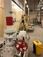
We conduct comprehensive surveys for water, wastewater, fiber, and transportation projects. Our services include property ownership verification, right-of-way documentation, and surface improvement mapping. This ensures accurate planning for both above-ground and underground utilities while maintaining compliance with local regulations.
ALTA/NSPS Surveys
Our ALTA/NSPS Land Title Surveys provide standardized commercial and residential property assessments. We follow national guidelines to deliver detailed boundary information, easement documentation, and improvement locations. This service includes Table A checklist compliance verification for complete title insurance preparation.
Property Line Disputes
We create legally recorded Land Survey Plats to resolve property line conflicts. Our process identifies encroachments, locates existing pins, and documents easements. Surveys include 5-foot buffer zone improvements and comply with Colorado legal requirements for court-admissible documentation.
Mining Claim Surveys
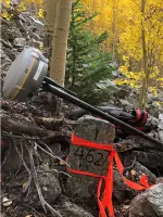
Our team locates original mining claim markers through field investigations and BLM records research. We document boundary evidence and provide coordinate-based mapping for claim validation. This service supports mineral rights documentation and legal claim establishment.
FEMA Elevation Certificates
We determine floodplain status for commercial and residential properties through elevation surveys. Our certificates support flood insurance requirements and include detailed elevation data relative to base flood levels. This service helps property owners understand and mitigate flood risk exposure.
People
Bill Buntrock
Owner/President
Professional Land Surveyor with 35+ years experience licensed in 5 states. Serves on Colorado's State Board of Licensure and holds National Council certification #1135. Army veteran with Cold War/Gulf War service in Germany.
Questions
What surveying services do you specialize in?
We focus on utility design, ALTA/NSPS title surveys, property line disputes, mining claims, and FEMA elevation certificates for Colorado clients.
How quickly can you respond to emergencies?
Our team can meet clients within hours of contact for urgent surveying needs and critical project timelines.
Do you handle residential and commercial projects?
Yes, we provide ALTA/NSPS surveys for commercial properties and boundary resolution services for residential clients.
What areas do you serve?
We operate throughout Colorado including Denver Metro, Douglas County, Colorado Springs, and surrounding regions.
Are your surveys legally recognized?
All boundary surveys meet Colorado legal requirements and can be recorded with county authorities for official documentation.