Business Details
14 Years
experience
Professional Land Surveying Services in Tampa, FL
Impact Surveying & Mapping was founded in 2012 with a commitment to delivering the highest level of service for every project. Our team brings over 60 years of combined professional experience in land surveying and mapping, ensuring precision and reliability for clients across diverse industries. We specialize in boundary surveys, topographic mapping, wetland delineation, and construction staking, serving projects ranging from small residential lots to large-scale developments. Our dedication to quality has earned us a reputation as the gold standard in surveying, supported by client referrals and consistent service excellence.We continuously invest in expanding our team and capabilities to meet evolving client needs while maintaining the personalized attention that defines our approach. Our expertise spans collaboration with civil engineers, environmental consultants, and utility providers to deliver comprehensive solutions tailored to each project's unique requirements.

Services
Boundary Surveys
Design Surveys
Topographic Surveys
Wetland Delineation
Construction Staking
ALTA Surveys
As-Built Surveys
Details
- Year established: 2012
Highlights and features
- We offer over 60 years of combined professional surveying experience.
- Our team provides comprehensive land surveying services for projects of all sizes.
- We maintain partnerships with civil engineers and environmental consultants.
- We deliver precise data for boundary determination, construction, and environmental compliance.
- Our reputation is built on client referrals and consistent service excellence.
Services
Boundary Surveys
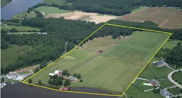
We conduct precise boundary surveys to define property lines for residential, commercial, and industrial properties. Our surveys ensure legal compliance and resolve disputes by identifying easements and encroachments. Clients receive detailed documentation for real estate transactions, development planning, and land management.
Topographic Surveys
Our topographic surveys capture natural and man-made features to create detailed elevation models. This data supports site planning, construction design, and environmental impact assessments. We use advanced equipment to ensure accuracy for projects requiring precise terrain analysis.
Construction Staking
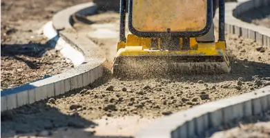
We provide construction staking services to guide infrastructure development with exact positioning of buildings, roads, and utilities. Our work ensures adherence to design specifications and minimizes costly errors during construction. Clients benefit from reduced delays and improved project efficiency.
Wetland Delineation
Our wetland delineation services identify jurisdictional wetlands to support regulatory compliance and land development. We assess soil, vegetation, and hydrology to define boundaries for permits and mitigation plans. This service helps clients navigate environmental regulations while protecting ecosystems.
ALTA Surveys
We perform ALTA/ACSM land title surveys to meet national standards for commercial real estate transactions. These comprehensive surveys include boundary details, improvements, and encumbrances to reduce legal risks. Clients receive certified maps for title insurance and property acquisitions.
People
David Peach
Vice President
With decades of experience in land surveying, David Peach oversees project execution and client relations at Impact Surveying. His expertise ensures technical precision and adherence to industry standards across all projects.
Joanne Peach
President/Office Manager
Joanne Peach manages administrative operations and client communications, ensuring seamless project coordination. Her leadership supports the team's efficiency and commitment to delivering high-quality surveying services.
Questions
What types of surveying services do you offer?
We provide boundary surveys, topographic mapping, construction staking, wetland delineation, and ALTA/ACSM land title surveys for residential, commercial, and industrial projects.
How long has your company been in business?
Impact Surveying and Mapping has served clients since 2012, with over 60 years of combined experience among our team members.
Do you work on large-scale development projects?
Yes, we handle projects of all sizes, from small parcels to large developments, collaborating with engineers and environmental consultants as needed.
Are your surveyors licensed professionals?
Yes, our team includes licensed Professional Surveyors and Mappers with extensive expertise in land surveying and mapping services.