Business Details
28 Years
experience
Your Trusted Land Surveying Partner in San Antonio
Established in 1998, Westar Alamo Land Surveyors has built a reputation for delivering precise and reliable land surveying services across San Antonio and surrounding regions. Our team operates under the rigorous standards set by the Texas Board of Professional Land Surveyors, ensuring every project adheres to state regulations and industry best practices. With decades of combined experience, we specialize in boundary, topographic, and construction staking surveys, utilizing advanced technology to enhance accuracy and efficiency.Our commitment to client satisfaction drives us to prioritize clear communication, timely execution, and tailored solutions for residential, commercial, and engineering projects. By maintaining transparency and leveraging modern tools like GPS and broadband data transfer, we consistently meet the evolving needs of our clients while upholding the highest ethical standards in the profession.

Services
Boundary Surveys
ALTA Surveys
Topographic Surveys
Tree Surveys
Locative Surveys
Elevation Certificates
Platting Surveys
As-Built Surveys
Construction Staking
TABC Surveys
Details
- Year established: 1998
Highlights and features
- We offer 25 years of expertise in land surveying services.
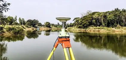
- Our team uses modern GPS and digital technology for accuracy.
- We are licensed by the Texas Board of Professional Land Surveyors.
- Our surveys meet strict standards for residential and commercial needs.
- We prioritize timely delivery and clear communication with clients.
Services
Boundary Surveys
Boundary surveys establish property lines and legal descriptions using precise measurements. These surveys are essential for land transfers, resolving disputes, and planning improvements. Our licensed professionals employ GPS and field equipment to ensure compliance with Texas standards, providing clear documentation for title companies, lenders, and property owners.
ALTA Surveys
ALTA surveys meet the American Land Title Association's rigorous standards for commercial property transactions. These detailed surveys include boundary verification, easements, and improvements, ensuring lenders and buyers have accurate data. We collaborate with title companies to deliver comprehensive reports for risk assessment and legal compliance.
Topographic Surveys
Topographic surveys map natural and man-made features, including elevation changes, vegetation, and structures. These surveys support engineering and construction projects by providing terrain data. Our team uses advanced tools to create detailed plans for site development, drainage analysis, and infrastructure planning.
Construction Staking
Construction staking marks precise locations for buildings, roads, and utilities based on design plans. This service ensures projects adhere to approved specifications, minimizing errors. We work with contractors to verify horizontal and vertical placements, supporting efficient construction and compliance with local regulations.
Elevation Certificates
Elevation certificates document a property's elevation relative to flood zones, required for flood insurance. Our surveys determine base flood elevations and compliance with FEMA guidelines. This service helps homeowners and lenders assess flood risk and potentially reduce insurance costs.
Questions
What types of land surveys do you offer?
We provide boundary, ALTA, topographic, tree, locative, elevation certificates, platting, as-built, TABC, and construction staking surveys.
How do I determine which survey I need?
Our team consults with you to recommend the right survey based on property type, project goals, and regulatory requirements.
Do you serve both residential and commercial clients?
Yes, we offer tailored surveying solutions for residential properties, commercial developments, and construction projects.
Are your surveyors licensed in Texas?
All our professionals are licensed by the Texas Board of Professional Land Surveyors.
How do you ensure accuracy in your surveys?
We use advanced GPS technology and digital tools to deliver precise measurements and data.