Business Details
43 Years
experience
Accurate and Reliable Land Surveying Services in South Florida
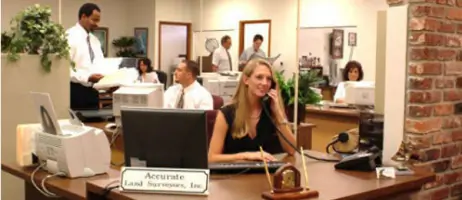
Founded in 1983 by Robert L. Thompson, a seasoned professional with extensive experience as the Port Everglades Surveyor and Broward County Surveyor, Accurate Land Surveyors has performed over 100,000 surveys across South Florida. Our team combines advanced technology with decades of expertise to deliver precise, legally sound surveying solutions for residential, commercial, and governmental clients. Licensed by Florida's Department of Professional Regulation and members of the Florida Society of Professional Land Surveyors, we prioritize accuracy, efficiency, and client satisfaction.Our proprietary software enables a 72-hour turnaround while maintaining strict adherence to legal documentation standards. With radio-dispatched field crews and dedicated survey managers overseeing every project, we ensure seamless collaboration with title companies, attorneys, and construction professionals to protect property rights and facilitate successful real estate transactions.

Services
Boundary Survey
Location Survey
Subdivision Survey
Elevation Certificate
Topographic Survey
Construction Layout
Hydrographic Survey
Property Dispute Survey
Details
- Year established: 1983
Highlights and features
- 30+ years of continuous service to South Florida real estate industry
- Proprietary software enables 72-hour turnaround for survey projects
- Licensed professionals with expertise in legal documentation verification
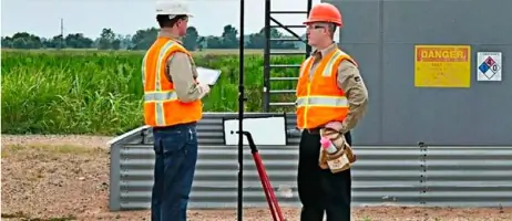
- Radio-dispatched field crews with state-of-the-art surveying equipment
- Dedicated survey managers ensure project accuracy and timely delivery
Associations and certifications
- Department of Professional Regulation
- Florida Society of Professional Land Surveyors
What people say
They Are The Best
Accurate and speedy too
Seasoned professionals exceed needs
Fast friendly and professional
Always accommodating and efficient
Services
Boundary Survey
Our boundary surveys precisely define property lines using iron rod markers and advanced measuring equipment. This service helps prevent encroachments during fence installation, pool construction, or property improvements. Clients receive legally documented boundary lines that enhance property value and resolve disputes.
Elevation Certificate
We provide FEMA-compliant elevation certificates that determine flood insurance requirements and premiums. Using GPS and robotic total stations, our surveys meet National Flood Insurance Program standards. This documentation supports map amendment requests and ensures compliance with floodplain management regulations.
Topographic Survey
Our topographic surveys map natural and man-made features including elevations, utilities, and contours. This data supports architectural planning, drainage analysis, and infrastructure development. Surveys combine aerial photography with ground verification for comprehensive site analysis.
Construction Layout
We provide precise construction layout services that guide building placement and infrastructure development. Our team marks exact locations for foundations, utilities, and improvements using digital data integration. This ensures compliance with zoning codes and design specifications.
Subdivision Survey
Our subdivision surveys divide properties into smaller parcels while meeting local government requirements. Services include street design, drainage planning, and legal documentation. We handle all aspects from initial platting to final recording with county authorities.
People
Robert L. Thompson
President
Founder with over 30 years of surveying experience, including roles as Port Everglades Surveyor and Broward County Surveyor. Licensed professional with expertise in legal documentation review and real estate transaction support.
Questions
What types of surveys do you offer?
We provide boundary surveys, elevation certificates, topographic surveys, construction layout, subdivision surveys, and specialized hydrographic surveys for coastal properties.
How quickly can you complete a survey?
Our standard turnaround time is 72 hours using proprietary software and radio-dispatched field crews while maintaining 100% accuracy in all deliverables.
Which areas do you serve?
We serve Miami-Dade, Broward, Palm Beach, Martin, St. Lucie, Monroe, Hillsborough, Manatee, Lee, and Pinellas counties across South Florida.
Are your surveyors licensed professionals?
All our surveyors are licensed by Florida's Department of Professional Regulation and members of the Florida Society of Professional Land Surveyors.
How do you handle urgent survey requests?
We prioritize time-sensitive projects and have accommodated urgent needs for 30+ years while maintaining our commitment to accuracy and legal compliance.
What technology do you use?
We utilize GPS systems, robotic total stations, and proprietary software for data collection, analysis, and rapid delivery of survey results.