
Business Details
43 Years
experience
Expert Land Surveying Services in San Antonio
At Ruiz & Associates Surveying, we bring over 35 years of specialized expertise to every project. Our team, led by registered professional land surveyor Ramon Ruiz, delivers precise and reliable surveying solutions tailored to client needs. With two decades of continuous service in San Antonio, we combine deep local knowledge with advanced technology like Trimble GPS equipment and CADD drafting systems. Our comprehensive services span land subdivisions, topographic mapping, construction staking, and specialized surveys for government and commercial clients. We maintain strict adherence to professional standards while offering transparent pricing and free project estimates.Our commitment to accuracy has established us as a trusted partner for boundary determinations, development projects, and legal documentation. We serve clients within a 50-mile radius of San Antonio, supporting both large-scale infrastructure and private property needs. Our experience with municipal projects, environmental surveys, and FEMA certifications demonstrates our technical versatility. As active members of professional associations, we stay current with industry advancements to better serve our clients. Our office maintains regular business hours with appointment availability for urgent requirements.

Services
Land Surveying
Replats and Subdivision Plats
Topographic Surveys
Construction Staking
ALTA/ASCM Surveys
FEMA Flood Certifications
Details
- Year established: 1983
Highlights and features
- We offer 35 years of specialized land surveying experience
- Our team uses state-of-the-art Trimble GPS equipment
- We provide free project estimates with no hidden fees
- We serve clients within a 50-mile radius of San Antonio
- Our president is a registered professional land surveyor
Associations and certifications
- Registered Professional Land Surveyor
Services
Land Surveying
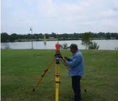
We conduct comprehensive land surveys to determine property boundaries and legal descriptions. Our services support real estate transactions, construction projects, and legal documentation. Utilizing advanced GPS technology ensures precise measurements for residential and commercial clients.
Construction Staking
Our construction staking services establish accurate reference points for building projects. Using GPS equipment, we mark locations for foundations, utilities, and structures. This ensures compliance with design plans and local regulations for commercial and residential developments.
Topographic Surveys
We create detailed topographic maps showing natural and man-made features. These surveys document elevation changes, vegetation, and existing structures. Clients use this data for site planning, environmental assessments, and engineering designs.
ALTA/ASCM Surveys
Our ALTA/ASCM surveys meet national standards for commercial property transactions. These detailed surveys identify boundary lines, easements, and improvements. Title companies and lenders rely on these surveys for risk assessment during property acquisitions.
FEMA Flood Certifications
We provide official flood certification for properties in San Antonio. These determinations identify flood risk zones for insurance requirements. Our surveys help property owners understand floodplain regulations and mitigation options.
People
Ramon Ruiz
President
With over 35 years of experience, Ramon Ruiz leads our surveying team as registered professional land surveyor. His expertise spans municipal projects, environmental surveys, and boundary resolution. He ensures all work meets strict accuracy standards.
Questions
What types of surveying services do you offer?
We provide boundary surveys, topographic mapping, construction staking, ALTA/ASCM surveys, and FEMA flood certifications for residential and commercial clients.
How long have you been in business?
We've provided surveying services in San Antonio since 1983 with over 35 years of combined experience from our team.
Do you offer free estimates?
Yes, we provide free project estimates with no hidden fees or obligations before starting any surveying work.
What areas do you serve?
We operate within a 50-mile radius of San Antonio, Texas, covering Bexar County and surrounding regions.
What technology do you use?
Our team utilizes Trimble GPS equipment, electronic data collection systems, and CADD automated drafting software for precise results.