Business Details
Professional Land Surveying Services in Southern California
Builoff Surveying & Mapping is a certified Small Business Enterprise dedicated to delivering professional land surveying and mapping services across Southern California. With decades of combined experience, our team specializes in supporting residential, commercial, and public sector clients through advanced technological resources and precise methodologies. We prioritize legal compliance and local land regulations while offering tailored solutions for property owners, real estate developers, architects, and construction professionals. Our commitment to quality is reflected in our use of state-of-the-art equipment and software, ensuring accurate data collection and project execution. We serve diverse markets including Los Angeles, Malibu, Glendale, and Santa Monica, providing services such as topographic mapping, aerial surveys, and construction layout.Our expertise in boundary surveys, 3D modeling, and ALTA/ACSM land title surveys ensures clients receive reliable data for informed decision-making. We emphasize transparency, client collaboration, and adherence to industry standards, fostering trust through consistent project delivery. Our local knowledge and technical proficiency position us as a dependable partner for complex land development needs. By integrating innovative tools like LIDAR and BIM, we enhance project efficiency while maintaining rigorous attention to detail. Our mission is to empower clients with actionable insights that streamline construction, design, and property management processes.
Services
Land Surveying
Mapping Services
3D Modeling
Aerial Mapping
Construction Layout
Topographic Surveys
Boundary Surveys
ALTA Surveys
Subdivision Mapping
Reality Capture
Highlights and features
- We utilize state-of-the-art surveying equipment and 3D modeling software for unmatched accuracy.
- Our team ensures strict adherence to California land laws and local regulatory requirements.
- We serve diverse clients including property owners, developers, and public agencies across Southern California.
- We offer specialized services like ALTA/ACSM surveys and LIDAR-based mapping for complex projects.
- Our 30+ years of combined experience guarantees reliable data for informed property decisions.
Associations and certifications
- Small Business Enterprise (SBE) Certification
Services
Land Surveying
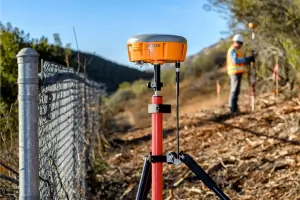
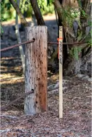
Our land surveying services provide precise measurements and legal documentation for property boundaries. Using advanced GPS and total station technology, we ensure compliance with California land regulations. Clients receive detailed maps and reports for real estate transactions, construction projects, or dispute resolution.
Aerial Mapping
Aerial mapping utilizes drone technology to create high-resolution topographic maps and 3D models. This service supports large-scale construction planning, environmental assessments, and land development projects. Our FAA-certified pilots capture data efficiently while maintaining regulatory compliance.
3D Modeling
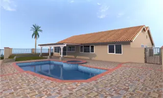
We generate accurate 3D models for architectural visualization, construction coordination, and BIM integration. Our models incorporate LIDAR scans and photogrammetry to support design validation and facility management. Clients benefit from enhanced spatial analysis and project visualization.
Construction Layout
Our construction layout services ensure precise placement of buildings, utilities, and infrastructure. Using robotic total stations and digital plans, we mark critical points for grading, foundations, and structural elements. This minimizes errors and accelerates project timelines for developers and contractors.
ALTA Surveys
ALTA/ACSM land title surveys meet national standards for commercial property transactions. We identify easements, encroachments, and legal boundaries while adhering to title insurance requirements. Clients receive comprehensive documentation for risk assessment and property acquisition.
Questions
What geographic areas do you serve?
We provide services throughout Southern California, including Los Angeles, Malibu, Glendale, Santa Monica, and Calabasas.
What types of land surveying services do you offer?
Our services include boundary surveys, topographic mapping, ALTA/ACSM surveys, construction layout, aerial mapping, and 3D modeling using LIDAR and BIM technology.
Are your surveyors licensed in California?
Yes, all our surveyors hold active California professional licenses and maintain compliance with state-specific land regulations.
How do you ensure legal compliance for surveys?
We verify all work against local zoning codes, property records, and state laws to ensure legal defensibility and regulatory approval.
Can you handle both residential and commercial projects?
We serve residential property owners, commercial developers, and public agencies with tailored surveying solutions for any project scale.
What technology do you use for mapping?
We employ GPS systems, robotic total stations, drones, LIDAR scanning, and advanced software for precise data collection and modeling.