Business Details
26 Years
experience
Your Trusted Land Surveying Experts in Tahoe City
Webb Land Surveying was founded in 2000 and has been serving the Lake Tahoe and Truckee regions for over two decades. Our team of four professionals brings more than 50 years of combined local experience to every project, ensuring deep familiarity with the unique challenges of the Tahoe-Truckee area. We specialize in topographic mapping, boundary surveys, bathymetric surveys, and construction staking, leveraging our expertise to streamline the planning process for clients. Our staff maintains strong relationships with local agencies, including the Tahoe Regional Planning Agency and Placer County authorities, to facilitate efficient project approvals. We pride ourselves on delivering accurate, timely results for residential, commercial, and municipal clients across four counties in California and Nevada.Our commitment to quality is reflected in our efficient systems and proven track record of successful project completion. By focusing exclusively on the Tahoe-Truckee region, weve developed unparalleled knowledge of local terrain, regulations, and community needs. Our small-company responsiveness combined with extensive technical expertise makes us the preferred choice for land surveying in this distinctive environment. We work closely with architects, engineers, and contractors to ensure seamless integration of survey data into broader development projects. Whether you need precise boundary determinations or complex topographic analyses, our team provides the professional support necessary to move your project forward confidently.
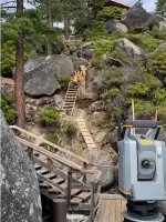
Services
Topographic Mapping
Boundary Surveys
Bathymetric Surveys
Construction Staking
Details
- Year established: 2000
Highlights and features
- Our team has 50+ years of local surveying experience in Tahoe-Truckee
- We maintain established relationships with regional planning agencies
- Specialized expertise in Tahoe's challenging terrain and regulatory environment
- Proven track record of efficient topographic mapping and boundary resolution
- Direct collaboration with local architects, engineers, and contractors
Services
Topographic Mapping
Our topographic mapping service creates detailed elevation models and terrain analyses for development projects. Using advanced surveying equipment and established workflows, we produce accurate site plans and TRPA coverage maps faster than any other local provider. This foundational data helps architects and engineers design structures that harmonize with Tahoe's unique landscape while meeting regulatory requirements.
Boundary Surveys
Boundary surveys establish precise property lines using historical records and on-site measurements. Our team leverages decades of local experience to locate existing property corners or install new markers when necessary. This service resolves disputes, supports property transactions, and ensures compliance with county regulations across Tahoe-Truckee's complex land ownership patterns.
Bathymetric Surveys
Bathymetric surveys map underwater terrain for properties on Lake Tahoe and Donner Lake. We combine shoreline assessments with submerged topography data to support pier design, environmental compliance, and waterfront development. Our specialized equipment captures accurate depth measurements and underwater features required for TRPA permitting and construction planning.
Construction Staking
Construction staking translates design plans into physical markers for building projects. We provide rapid response times and coordinate directly with contractors to ensure accurate placement of foundations, utilities, and structures. This service maintains alignment with approved plans while accommodating field adjustments during Tahoe-Truckee's challenging construction seasons.
Questions
What land surveying services do you offer?
We provide topographic mapping, boundary surveys, bathymetric surveys, and construction staking services for residential, commercial, and municipal projects in the Tahoe-Truckee region.
How long have you been serving the Tahoe area?
Webb Land Surveying has operated in Lake Tahoe and Truckee since 2000, with our team accumulating over 50 years of combined local surveying experience.
Which counties do you work in?
We serve Placer County, Nevada County, and El Dorado County in California, along with Washoe County in Nevada.
How do you handle complex regulatory requirements?
Our deep understanding of local agencies like TRPA and Placer County planning departments helps streamline permitting processes for your development projects.
What makes your team qualified for Tahoe's terrain?
Our four-member team has completed surveys in virtually every Tahoe-Truckee neighborhood, giving us unmatched knowledge of local topography, snow conditions, and regulatory challenges.