Business Details
8 Years
experience
Your Trusted Land Surveyors in Reno, Nevada
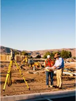
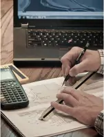
Meyer Surveying has been delivering precise and reliable land surveying services in Reno, Nevada since 2018. Our team combines over 15 years of regional expertise with cutting-edge technology to provide boundary surveys, topographic mapping, and construction staking solutions tailored to each client's unique needs. We maintain active licenses in both Nevada and California, ensuring compliance with the highest industry standards. Our principal surveyor, Randy Meyer, personally oversees every project from initial research through final documentation, guaranteeing consistent quality and accuracy. We specialize in identifying potential project conflicts early, saving clients time and money while maintaining strict adherence to legal and engineering requirements. Our commitment to excellence extends to using advanced CAD/GIS software and precision instruments that enhance efficiency without compromising quality.We serve a diverse clientele including real estate professionals, developers, and construction teams across the Reno-Sparks metropolitan area and Tahoe/Truckee region. Our reputation for timely delivery and budget-conscious solutions has made us a trusted partner for both individual property owners and large-scale development projects. We maintain active memberships in the Nevada and California Associations of Land Surveyors, demonstrating our ongoing commitment to professional development and industry best practices. Every survey we produce meets or exceeds state and federal regulatory requirements, providing clients with legally defensible documentation for their land-related endeavors.
Services
Boundary Survey
Topographic Survey
Construction Staking
GIS Mapping
ALTA Survey
FEMA Certification
Land Use Planning
Civil Design
Project Management
Mapping Services
Details
- Year established: 2018
Highlights and features
- We have 15+ years of surveying experience in the Reno-Tahoe region
- Our principal surveyor personally oversees every project from start to finish
- We utilize the latest surveying technology for improved accuracy and efficiency
- Our services meet or exceed all state and federal regulatory requirements
- We specialize in identifying potential project conflicts before they become problems
Services
Boundary Survey
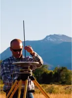
Our boundary surveys precisely establish property lines using advanced GPS technology and historical records. This service helps resolve disputes, supports real estate transactions, and ensures compliance with local zoning regulations. Clients receive detailed documentation that meets all legal requirements for property development and ownership verification.
Topographic Survey
We create detailed topographic maps showing natural and man-made features using 3D laser scanning and drone technology. This information supports construction planning, drainage analysis, and environmental assessments. Our surveys provide accurate elevation data essential for engineering and architectural design projects.
Construction Staking
Our construction staking services guide building projects with precise physical markers for foundations and infrastructure. We work closely with contractors to maintain alignment with design plans throughout the building process. This ensures proper placement of structures while minimizing costly rework during construction phases.
GIS Mapping
We develop comprehensive GIS mapping solutions that integrate spatial data with property information systems. This service supports urban planning, utility management, and environmental monitoring applications. Our digital mapping tools enable clients to visualize complex land relationships and make data-driven decisions for land development projects.
ALTA Survey
Our ALTA surveys meet the strict standards required for commercial real estate transactions. These detailed surveys show property boundaries, improvements, easements, and other critical features affecting title insurance. We work closely with title companies to ensure all American Land Title Association requirements are fully satisfied for major property acquisitions.
People
John Randy Meyer
Principal Surveyor
Licensed in Nevada and California with 20 years of surveying experience, Randy Meyer leads all projects at Meyer Surveying. He specializes in boundary resolution, construction staking, and land development across the Reno-Tahoe region, ensuring technical excellence and client satisfaction.
Questions
What surveying services do you offer?
We provide boundary surveys, topographic mapping, construction staking, GIS mapping, ALTA surveys, and FEMA certifications for residential, commercial, and infrastructure projects in northern Nevada.
Are you licensed in Nevada and California?
Yes, we hold active Professional Land Surveyor licenses in both Nevada (#20793) and California (#8907) with full compliance to state-specific surveying standards and regulations.
How long have you been in business?
Meyer Surveying has operated since 2018, with our principal surveyor maintaining 20 years of regional experience in land surveying and project management across three western states.
Do you offer free consultations?
Yes, we provide complimentary initial consultations with a licensed surveyor to discuss your project requirements and determine the appropriate survey type for your specific needs.
What areas do you serve?
We primarily serve Reno, Sparks, Tahoe/Truckee, and surrounding areas in northern Nevada, with additional capabilities for projects in California's Sierra region.
How do you ensure survey accuracy?
We use modern GPS equipment, robotic total stations, and 3D laser scanning technology combined with rigorous quality control processes to maintain the highest standards of measurement precision.